Montes Azules Biosphere Reserve
What is Montes Azules
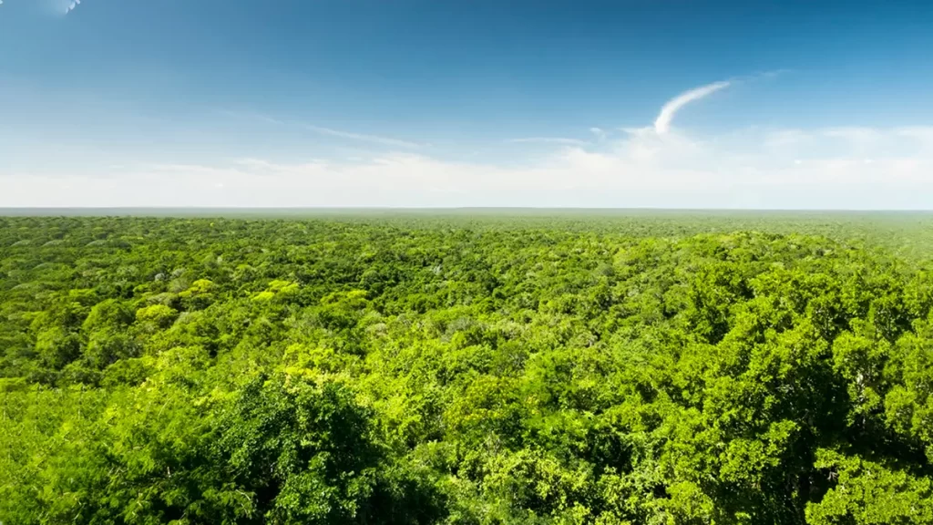
The Montes Azules Biosphere Reserve is a federal Protected Natural Area in eastern Chiapas, at the heart of the Lacandon Rainforest, and forms part of Mesoamerica’s most important humid-forest corridor.
With a surface of 331,200 hectares and the category of Biosphere Reserve, it safeguards tall and medium evergreen forests, karstic lagoons, and main rivers that sustain ecological processes of high value for Mexico and the region.
Although the Montes Azules Biosphere Reserve covers just 0.16% of the national territory, its biodiversity represents ≈20% of plant species, 30% of bird species, 27% of mammal species, and 17% of freshwater fish in Mexico; it also concentrates 44% of Mexico’s diurnal butterflies.
These figures justify its prioritization within the Gran Selva Maya and guide public-use planning under low-impact criteria.
The area was decreed on January 12, 1978 and, one year later, joined the World Network of Biosphere Reserves (UNESCO–MAB, 1979), a recognition that underscores its global value and the need to harmonize conservation, research, and sustainable local development.
Decree, MAB recognition, and Management Program

The 1978 declaration establishes the figure of Biosphere Reserve and its governance framework; in 2002 the Management Program was published, the technical-administrative instrument that regulates activities, zones, and operational guidelines to conserve biological and cultural resources.
This framework is complemented by membership in UNESCO–MAB (1979), which promotes applied research, monitoring, and environmental education in biocultural landscapes such as the Lacandon Rainforest.
Within the National System of Protected Natural Areas (SINAP), RBMA has a record and data sheet documenting its area, category, and date of incorporation, facilitating access to information and inter-institutional coordination.
Ecosystems and notable ecological phenomena
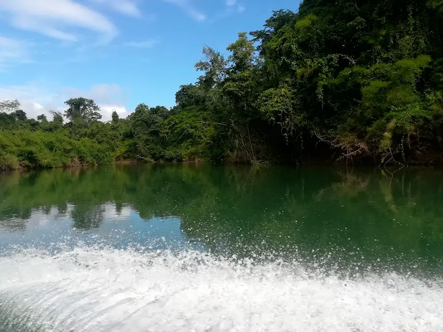
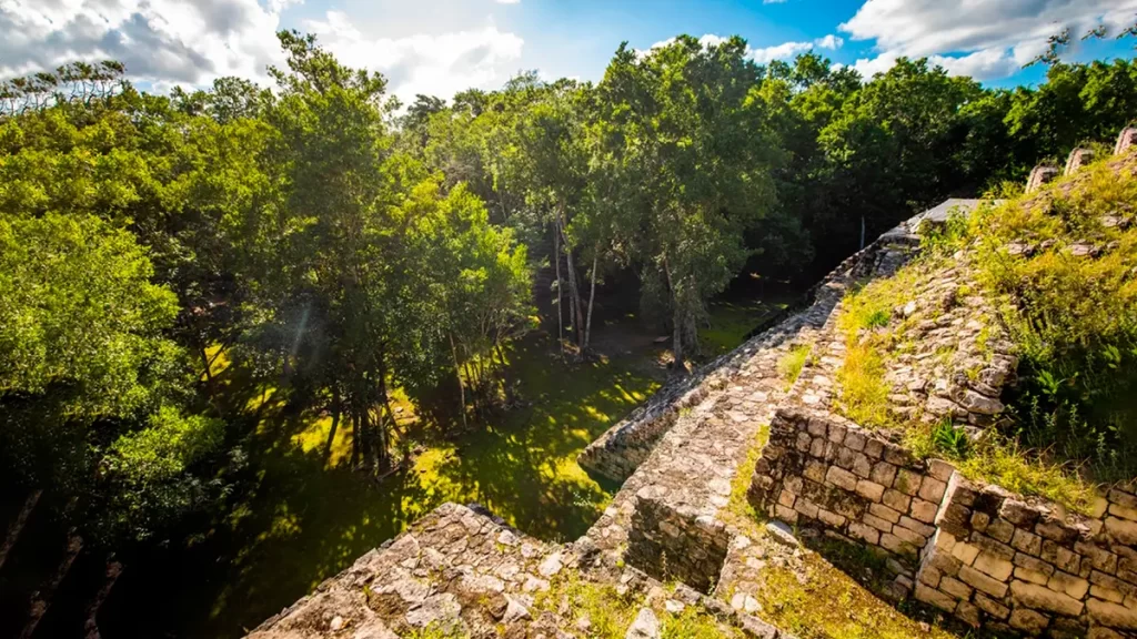
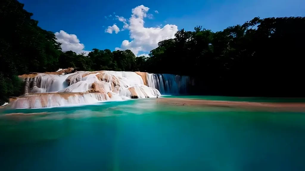
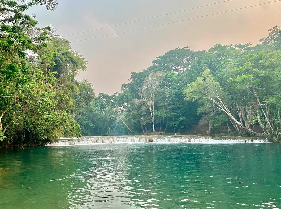
Montes Azules integrates a mosaic of evergreen forests (tall and medium), karstic lagoons and rivers—including Lacantún, Usumacinta, Tzendales, Negro, and San Pedro—that shape a landscape of high biological productivity.
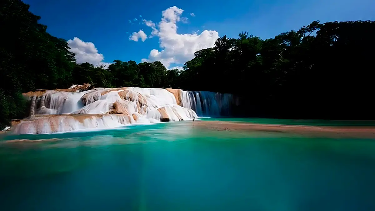
Laguna Miramar and the Lacanjá basin stand out for their scenic quality and relevance to connectivity for amphibians, fish, and waterbirds, as well as for their importance to education and environmental interpretation.
The heterogeneous forest structure is expressed in extraordinary indicators: a single hectare can harbor ≈160 species of vascular plants and up to 7,000 trees; on a single tree there may coexist ≈70 orchid species and hundreds of insects—figures that illustrate the system’s complexity and the need for very prudent visitation protocols.
The climate is predominantly warm humid, with 2,500–3,500 mm of annual rainfall across much of the reserve and mean temperatures of 24–26 °C; these conditions sustain evergreen forests and define the best windows for wildlife observation and interpretive boating.
Species and conservation
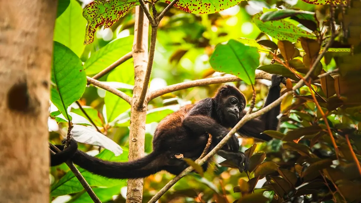
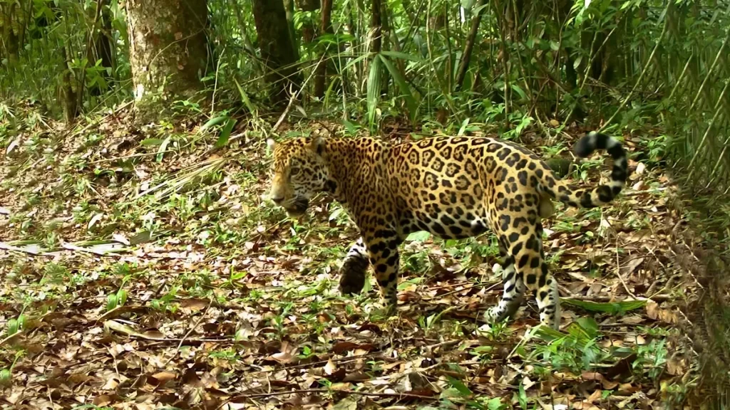
The RBMA protects populations of felids such as the jaguar and the ocelot, primates (spider and howler monkeys), tapir, white-lipped peccary, and birds including the scarlet macaw, among many others.
Reported conservation efforts in the reserve include population recovery for several at-risk species, through surveillance, fire management, control of illicit activities, and environmental education with riparian and Lacandon communities.
Rivers, wetlands, and lagoons contribute to the diversity of freshwater fish, while the forest mosaic supports a high diversity of diurnal butterflies (≈44% of Mexico’s total), used as a habitat-integrity indicator in monitoring programs.
Access and basic logistics for responsible visitation
The RBMA lies within the municipalities of Las Margaritas, Maravilla Tenejapa, and Ocosingo.
Regional access is via the Palenque–Ocosingo and Comitán–Las Margaritas road corridors, with connections to Lacanjá Chansayab, Frontera Corozal, and Lacandon communities that provide low-impact services.
Mobile coverage is limited, and planning for fuel, water, cash and coordination with local service providers is necessary.
Activities are recommended in small groups and at dawn and dusk to minimize heat stress and favor responsible observation.
Interpretive boating along the Lacantún and Usumacinta rivers, and hikes to Laguna Miramar and Lacanjá, are experiences highlighted by institutional sources and official promotion; they must be carried out with accredited guides and under guidance on river safety, observation distances, and time limits at sensitive sites (e.g., bird roosts).
Attractions and suggested routes
- Laguna Miramar: emblematic karstic lake with high transparency and striking landscapes; an ideal point for environmental education and nature photography (no drones, unless permitted).
- Lacanjá and trunk rivers (Lacantún, Usumacinta): interpretive boating, birding, and observation of riparian mammals, under strict protocols on distance and noise.
- Evergreen rainforest trails: guided walks for interpretation of flora, epiphytism, and pollination, leveraging the high per-hectare diversity documented in the reserve.
Operational note: All itineraries must comply with the Management Program and with guidance from the ANP Directorate and host communities.
Visitor best practices
- Stay on official trails and lookouts; do not open new paths.
- Small groups (≤10), quiet operation; no speakers.
- Observation distances: >50 m from mammals and >100 m at roosts or colonies; no playback and no flash directed at wildlife.
- Zero waste: everything you bring in, take out; avoid single-use plastics.
- Responsible boating: lifejackets, low speed, no approaches to eroding banks with wildlife.
- Permits for research/filming with the ANP Directorate (CONANP); respect the Management Program.
Frequently asked questions
Montes Azules Biosphere Reserve
The Montes Azules Biosphere Reserve is a biocultural landscape of continental importance, pivotal for connectivity and conservation in the Lacandon Rainforest.
Its combination of evergreen forests, rivers, and karstic lagoons, along with evidence of emblematic-fauna recovery, calls for informed visits and low-impact protocols that reinforce the objectives of the Management Program and the UNESCO–MAB mandate.
Coordination with communities and accredited guides is essential to maintain the area’s ecological functionality and the natural and cultural heritage that distinguish the reserve.
Table of ecosystems
Gran Selva Maya
Reserva de la Biósfera Montes Azules — Material oficial para descarga
Tabla de ecosistemas y especies focales + Buenas prácticas del visitante
Uso público responsable • Documento PDFFuente cartográfica y normativa
Decreto (12/01/1978), reconocimiento UNESCO-MAB (1979), Programa de Manejo (2002) y fichas oficiales CONANP/SIMEC. Para mapas, utilice el PDF oficial y/o shapes SIG de CONANP.
Para publicación web, incruste mapas oficiales de accesos y atractivos (Laguna Miramar, ríos Lacantún/Usumacinta) y mantenga leyendas y escala.
Tabla síntesis — Ecosistema ↔ Especie focal ↔ Ámbito de manejo ↔ Buenas prácticas
| Ecosistema (RBMA) | Especies focales (ejemplos) | Ámbito de manejo recomendado | Buenas prácticas clave |
|---|---|---|---|
| Selva Alta Perennifolia | Jaguar (Panthera onca), Mono araña (Ateles geoffroyi) | Núcleo: investigación/monitoreo. Amortiguamiento: observación de bajo impacto en senderos y bordes. | Grupos ≤10; silencio; distancia >50 m con mamíferos; sin playback; no seguir rastros. |
| Selva Mediana Perennifolia | Tapir (Tapirella bairdii), Pecarí de labios blancos (Tayassu pecari) | Núcleo: sin turismo; Amortiguamiento: rutas guiadas. | Velocidad <40 km/h en tramos con cruce de fauna; actividad preferente al amanecer/atardecer; sin iluminación directa a fauna. |
| Bosque Ribereño (Galería) | Guacamaya roja (Ara macao), Tucanes (Ramphastidae) | Núcleo: ciencia/monitoreo; Amortiguamiento: observación en puntos designados. | Respetar dormideros (≥100 m); no usar playback; limitar permanencia ≤15 min por punto. |
| Lagos kársticos (p. ej., Laguna Miramar) | Aves acuáticas; peces nativos (Rhamdia spp.) | Núcleo: sin uso público; Amortiguamiento: miradores y plataformas. | Sin jabones/repelentes en agua; no pisar orillas blandas; chaleco salvavidas en embarcaciones. |
| Ríos tropicales (Lacantún, Usumacinta, Tzendales) | Nutria neotropical (Lontra longicaudis), Tortugas de agua dulce | Núcleo: conservación; Amortiguamiento: navegación interpretativa con permiso. | Velocidad baja; no aproximarse a ribazos con fauna; motor en ralentí cerca de fauna; cero derrames. |
| Humedales y pantanos | Cocodrilo de pantano (Crocodylus moreletii), Garzas (Ardeidae) | Núcleo: preservación; Amortiguamiento: observación desde bordes/plataformas. | Distancia mínima 15 m a cocodrilos; sin drones; no ingreso al agua. |
| Acahual (selva secundaria) | Armadillo (Dasypus novemcinctus), Aves generalistas | Núcleo: N/A; Amortiguamiento: rutas educativas de bajo impacto. | Evitar abrir veredas; permanecer en caminos; reforzar educación ambiental y control de residuos. |
La presencia de fauna es estacional y variable por sitio. Ajustar rutas con guías locales y la Dirección del ANP. Este cuadro no sustituye permisos ni lineamientos del Programa de Manejo.
Buenas prácticas del visitante — Gran Selva Maya
Antes de la visita
- Consultar estado de caminos, clima y avisos oficiales.
- Reservar guías locales y servicios comunitarios acreditados.
- Planificar agua, alimentación, botiquín, linterna, efectivo y combustible.
Durante la visita
- Permanecer en senderos y miradores establecidos.
- Grupos pequeños (≤10) y silencio; sin bocinas.
- Mantener distancias >50 m con mamíferos y >100 m en dormideros/colonias.
- No drones en núcleos; en amortiguamiento, sólo con permiso.
- Cero residuos: todo lo que entra, sale; evitar plásticos de un solo uso.
Observación de fauna
- Sin playback ni señuelos; sin flash directo a fauna.
- No alimentación; no manipulación de flora/fauna.
- Respetar tiempos de estancia en puntos sensibles (≤15 min).
Agua y fuego
- No usar jabones ni químicos en lagos/aguadas.
- Prohibido el fuego en zonas núcleo; seguir protocolos en amortiguamiento.
Seguridad y comunicación
- Evitar conducir de noche; reportar itinerario; cobertura móvil limitada.
- Ropa de manga larga, sombrero, repelente; hidratación constante.
Investigación / filmación
- Tramitar permisos con la Dirección del ANP (CONANP).
- Aplicar protocolos de bioseguridad y normativa de colecta.
Créditos y contacto
Fuentes base: CONANP/SEMARNAT (fichas oficiales y Programa de Manejo 2002) y material de divulgación institucional sobre Montes Azules. Este documento es informativo y deberá usarse conforme al Programa de Manejo vigente.
Contacto: Dirección del Área Natural Protegida — CONANP • Portal Gran Selva Maya