Mirador Río Azul National Park
What Mirador Río Azul is and why it is key in the heart of the Great Mayan Forest
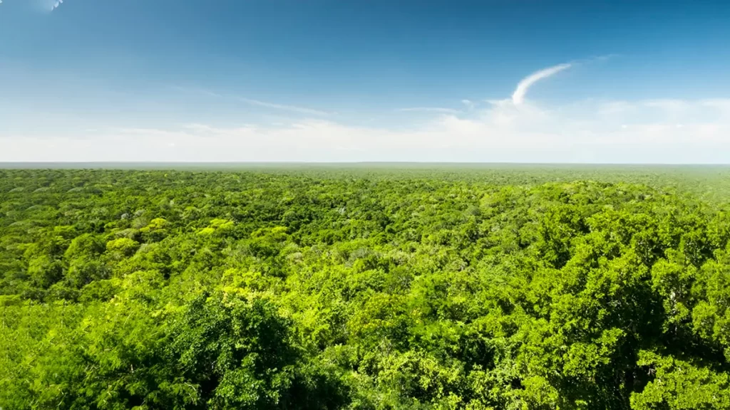
The Mirador Río Azul National Park is a strategic protected area in northern Petén, Guatemala, embedded in the Great Mayan Forest system and contiguous with the Naachtún–Dos Lagunas Protected Biotope.
With an official area of 116,911 ha and a declaration year of 1990, it safeguards tropical forests, karst systems, and a singular ecosystem known as “El Desierto”: gypsum outcrops with very low vegetation and endemic species unique in the country.
Scientific organizations underscore the ecological connectivity of the Mirador Río Azul National Park with the trinational forest block and the presence of focal species of high conservation value.
Biocultural heritage: Maya cities and singular ecosystems
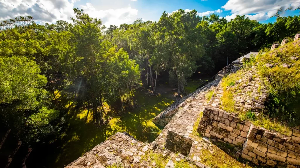
The park comprises a biocultural landscape where natural values coexist with archaeological sites of the Mirador basin:
El Mirador, Nakbé, Naachtún, Río Azul, Kinal, La Muralla, among others—many connected by Maya causeways up to 22 m wide and 20 km long.
This monumental network enables an integrated reading of the territory in which forest conservation and cultural heritage reinforce each other.
Within the park, “El Desierto”—a gypsophilous field—is unique in Guatemala for its geology, physiognomy, and associated flora/fauna; species restricted to this micro-habitat have been reported.
How to get there: official routes, times and entry requirements
Due to its remoteness, entry requires prior coordination with the park administration and mandatory accompaniment by Community Tourism Commissions authorized by CONAP.
The three routes officially disseminated from Flores are:
Rutas y tiempos estimados
- Route Carmelita → El Mirador → Mirador Río Azul National Park.
- Route Uaxactún → Dos Lagunas → El Cedro → “El Desierto” → Río Azul → Mirador Río Azul National Park.
- Route Melchor de Mencos → El Manantial → ZUM–RBM concessions → El Kinal → Río Azul → “El Desierto” → Mirador Río Azul National Park.
Access time: between 1 and 2 days, depending on itinerary, season, and contracted modality.
Reservations and authorizations must be managed by date.
Operational information: hours, fees, and legal framework
- Visiting hours: 07:00–17:00 (follow signage and staff guidance).
- Reference fees (SICultura): nationals Q40, foreign visitors Q80. Note: fees may change; please confirm with the park administration or CONAP before your visit.
- Associated decrees: 4-89 and 5-90 (legal framework of the area).
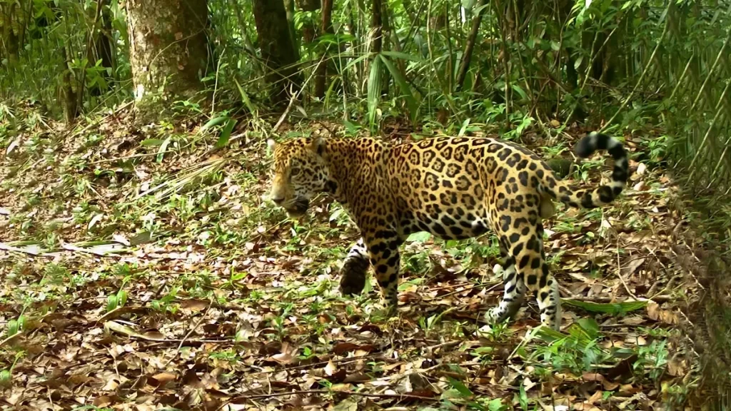
Biodiversity and emblematic species
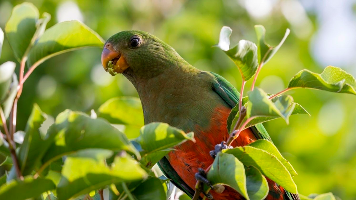
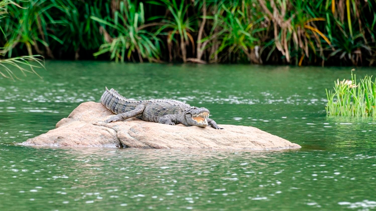
The Mirador Río Azul National Park harbors standout fauna of the Great Mayan Forest: jaguar, margay, crocodile, white turtle, and psittacids such as the mealy parrot, among others.
The forest matrix and the gypsophilous environments of “El Desierto” support assemblages with endemism and ecological processes that justify especially prudent public-use protocols.
Community-based tourism, safety, and responsible visitation
The Community Tourism Commissions of Carmelita, Uaxactún, and others, accredited by CONAP, lead route operations and logistics in this remote zone. To minimize impacts and risks, it is recommended to adopt:
- Small groups, accredited guides, and thorough planning (fuel, water, cash, overnighting).
- Observation distances from wildlife and quiet operation (no loudspeakers).
- Zero waste and strict respect for established trails/zones.
- Attention to advisories on fires, rainfall, and road conditions.
Frequently asked questions
Mirador Río Azul National Park
The Mirador–Río Azul National Park is a biocultural pillar of the Great Mayan Forest.
Its combination of Maya cities interconnected by monumental causeways and tropical ecosystems—including the gypsophilous field “El Desierto”—calls for informed visits, community accompaniment, and low-impact protocols.
Early coordination with the park administration and the Community Tourism Commissions ensures safety, heritage protection, and sustainable local benefits.
Table of ecosystems
Gran Selva Maya
Mirador–Río Azul National Park — Summary table for responsible public use
Summary Table — Mirador–Río Azul National Park
Ecosystem ↔ Focal species ↔ Visit objective ↔ Best practicesScope and guidelines
Scope: operational table for low‑impact public use. Apply CONAP guidelines and the mandatory accompaniment of Community Tourism Commissions. This material does not replace permits nor the area’s official plan/regulations.
| Ecosystem (PNMRA) | Focal species (examples) | Recommended visit objective | Key best practices |
|---|---|---|---|
| Tropical evergreen forest (tall/medium) | Jaguar (Panthera onca), margay (Leopardus wiedii), resident primates | Interpretation on designated trails with accredited guide; discreet observation | Groups ≤10, quiet operation, >50 m from mammals; no playback; do not track animals; stay on paths |
| “El Desierto” (gypsum outcrops, gypsophilous ecosystem) | Reptiles and endemic flora associated with gypsum substrates | Landscape reading from defined points; no off‑trail excursions in fragile micro‑habitats | Short dwell times, zero extraction; do not move rocks/plants; no drones unless permitted; wear smooth‑soled footwear to minimize footprint |
| Riparian forest / banks of the Río Azul | Morelet’s crocodile (Crocodylus moreletii), white turtle (Dermatemys mawii), riverine birds | Viewing from edges/platforms; interpretive boating only with authorized operation | Distance ≥15 m from crocodiles; lifejackets required; low speed; idle engine near wildlife; no water entry |
| Lagoons, aguadas and wetlands (e.g., Dos Lagunas) | Waterbirds; mammals visiting to drink | Lookouts and platforms; responsible nature photography | No soaps/repellents in water; avoid soft shores; dwell ≤15 min per point; >100 m at roosts/colonies |
| Secondary forest (acahual) and ecotones | Resident birds, armadillo (Dasypus novemcinctus) and small mammals | Low‑impact educational routes for interpretation of vegetation succession | Do not open new paths; remain on roads; zero waste; respect signage and operational limits |
| Archaeological settings within forest matrix (El Mirador, Nakbé, Naachtún, Río Azul, Kinal, La Muralla) | Mixed bird and invertebrate assemblages; understorey vegetation | Guided heritage visit; integrated biocultural interpretation | Do not touch/climb structures; keep distance from friezes and stelae; no flash in restricted spaces; follow official routes |
Entry: requires prior coordination with park administration and mandatory accompaniment by Community Tourism Commissions (Carmelita, Uaxactún, etc.). Hours: 07:00–17:00. Contact: (+502) 7926‑4158 • pn.miradorrioazul@gmail.com. Safety: limited mobile coverage; plan for fuel, water, and cash; avoid night driving; heed official advisories (weather, fires, roads).